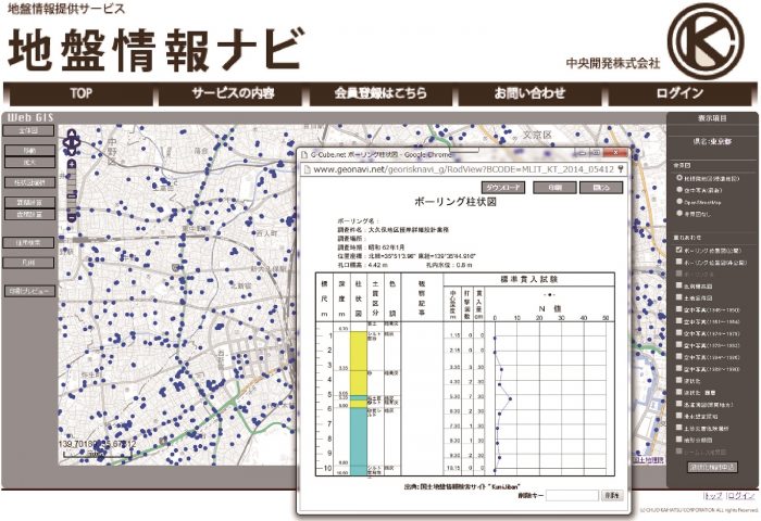
“Geotechnical information navigation” (jiban jouhou nabi) is an online service for distributing geotechnical information. Using WebGIS, this service allows users to overlay disaster hazard information with other geospatial information and easily browse and search the site.
In addition to approximately 300,000 drilling data entries published by the national and local governments, liquefaction risk level maps, sediment disaster risk level maps, and land condition maps are also available. By combining drilling data with land condition maps or geological maps, past topography can be seen. This service is used by a wide range of customers including government offices and private companies.
Geotechnical information navigation
Geotechnical information navigation